Friday, June 29, 2012

Trail Report: Mt. Webster / Mt. Jackson

I had headed over to Crawford Notch and hiked Mt. Webster and Mt. Jackson. We parked near the Gateway of the North and headed up the trail Webester-Jackson Trail. It was not that muddy at all and an enjoyable hike. We also had great weather. We stopped at Bugle Cliff to take a few pictures and then headed up the trail to the intersection where we then continued on Webester Branch. It took 1.4 miles to get to the Branch. After it was another 1.0 mile over to Mt. Webster.
Here are a few pictures we took along the way:

View from Bugle Cliff

Signs at the intersection between Mts.

Waterfall above Silver Cascades

Mt. Webster had some beautiful views. We stayed for awhile to eat our lunch and take pictures. Mt. Webster is 3910 ft high. I loved the view of Mt. Washington! Here are a few pictures of the views:

The first view we came upon when coming to the top of Mt. Webster
The view of Mt. Washington over the trees! What a beautiful clear day!
 After this we headed up to Mt. Jackson which was up the Webster Cliff Trail, another 1.3 miles. The trail was rocky in some parts but not bad to hike up. You are in the open a lot so you will be hot and the sun will be beating on you! We had lots of water and tried to find shade at times to stop and break. Mt. Jackson is 4052 ft and had some more lovely views! I had hiked it back in 2005 so I was excited to be back on top looking around again.
Here are a few pictures:

You can see Mt. Washington Hotel and Valley

The views were so beautiful and I could have stayed up there forever!
After enjoying the views and taking pictures we headed down the Jackson Branch (1.2 miles) which will connect back to the Webster-Jackson Trail. It was great for you get to hike two mountains and connect back to the same trail for you make a triangle. The hike all toegther is about 5.5 hours and 6.3miles! Great day hike! HAPPY HIKING!


Friday, June 22, 2012

Trail Report: Basin Cascaeds Tr/ Cascade Brook Tr./ Lonesome Lake

We started our hike at The Basin in Franconia Notch. There is enough parking and you don't have to pay to park. There is also parking on the other side and you cross under the road to get to the trail. At the same time you can also check out the Basin which is so beautiful in the summer. We started to head up the Basin Cascades Trail which is 1.1 miles long. There are some beautiful Falls to see, the Kinsman Falls and the Rocky Glen Falls.

Kinsman Falls

Rocky Glen Falls
After we past the falls we can across where the bridge is out. Last year we had a lot of rain in the New England that washed out roads and bridges. This bridge is still out and there is a sign that leads you to some rocks to cross the brook. You then are hiking up the Cascades Brook Trail for another .5 miles until you see a sign that tells you that you have .8 miles until you reach Lonesome Lake. the trail is very muddy and water sometimes runs in the trail when you get closer to the lake. We had on our H2O Bass shoes we got for some summer hiking. The water just runs through them and they dry quickly.

The sign to lets you know you have .8 miles to go

our awesome H20 Bass shoes
When we reached the lake, there were many hikers and visitors around. Many people come up to swim in the lake which seemed very cold to me, but you do get used to the temp after awhile. We took a break and ate at the Lonesome Lake Hut. It seemed they added a new addition on with some rooms. The trees were cut which gave a great view of the mountains.

The view of the mountains from the Lake

The newest addition with the view

The rooms in the newest addition
After we ate at the Lonesome Lake Hut we hiked around the lake which was fun. The lake is huge and you mostly walk on wood boards they put together to make a path. Its about .9 all the way around the pond and my stepson loved seeing the fish swimming in the lake and the salamanders.

Walking the planks...lol

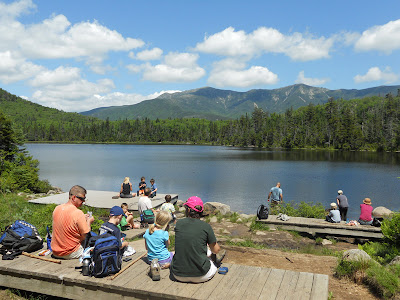
The view on the other side of the lake

 The hike all together was great. It was 5.6 miles all together. It wasn't a hard hike. Mostly moderate and a mostly wet trail. Great for children! Happy Hiking:)

Monday, June 18, 2012

Trail Report: Ammonoosuc Ravine Trail to Lake of the Clouds/ Mt. Monroe

This past Friday I went hiking with my wonderful stepson. We decided to do Ammonoosuc Ravine Trail up to Lake of the Clouds Hut and then to the top pf Mt. Monroe. This trail is located in the Presidential Range near the Cog Railway. We started at the Base Road Parking lot and headed up the path. It was very easy for the first 2.1 miles. Here is a few pics of the beginning of our adventure:

This is the pay station at the Base. I payed 3.00 for the day

The sign at the start of the trail: 3.1 miles to the Hut

My stepson loved the wood walking paths

Mys stepson asked many times where we were and when we were going to get to the top. He is eleven and loves to get to where he is going. He was fine up until we got to the Gem Pool. After that it gets steeper  and he was tired. We did stop at the Cascades/Gorge which he loved. It wasn't to long before we were above tree line and seeing some wonderful views. He likes when we started seeing the piles of rocks. He counted 13 of them before we got to the Lake of the Clouds where we took a break inside and ate.

The Gem Pool

The Gorge

Walking up the path to see Lake of the Clouds Hut and Mt. Monroe

We stayed in the hut for about twenty minutes. They had made some blueberry muffins and brownies so we had each one. The food is good and the price for each item are not bad. It only cost a dollar for each of our items. Plus they had soup for two dollars. After we headed up the path called Monroe Loop which is about .3 miles to the top pf Mt. Monroe. You can do the loop all the way around and connect to Crawford Path but we just went back the way we came up. For his first time doing a large hike he did a great job of keeping to the path and staying safe. I tried to guide he the best I could, I hope he continues to hike well after he leaves our home someday, and knows how to hike safely.
It is always wonderful when I see families hiking together and the children are outdoors. It good for everyone to enjoy nature at it's best!


Lake of the Clouds Hut: The food table it to the right:)

Mt. Washington, Lakes of the Clouds, and Lake of the Clouds Hut when hiking up Mt. Monroe

Me at the top of Mt. Monroe with Mt Washington in the background
The loop path below that also heads to the Hut
This hike is 6.8 miles round trip and took us around 5 and half hours to do. We had a great time and hope that you enjoy your next hiking adventure. Happy hiking:)

Monday, June 11, 2012

Trail Report: Zealand Trail up to Zealand Falls

I have always gone by the Zealand Campground, but never thought about going up the Zealand Road to hike. The last time I drove by the road, I thought maybe it was about time to drive up it and hike. So, this past weekend, I took my husband, and stepson on a hike up to Zealand Falls.. I have always wanted to see the hut and check out the area. To get to the Zealand Trail that takes you to the hut, you need to drive on Route 302. You will see Zealand Campground and a sign for Sugarloaf Camground, take that road which is called Zealand Road. There are three hiking parking stops on the way up, we went to the very last one which was at the end of the road. The road is 3.5 miles to the parking lot. You need a pass, or you can pay $3.00 dollars at the station when you get there. This helps pay for taking care of the area so more people can enjoy hiking.
PAY STATION near the trail! so don't forget your money!
We started on the trail at about 11:30 o'clock. My stepson took the lead and followed the trail. The trail was mostly wide at the beginning and clear. There had been a lot of rain the week before so some places were muddy. The 2.7 miles to Zealand Falls Hut and has some wonderful views along the way. We loved being in between mountains and soon we were near water. Pools of water where you  can see beaver dams and fish swimming. This was also a great place for moose to hang out though we didn't see any. The area was just lovely and they had some walking bridges, wooden pathways and logs for going over some of the water which my stepson loved. He enjoyed looking in over the water to see the fish and other small water creatures.
The view near one of the pond. It was so peaceful.

The logs and walkways over the water
The trail is mostly a gradual uphill hike, until you get very close to the hut. The last .2 miles in a long uphill rocky path. This part my stepson didn't care for and wanted to stop every few feet, though I tried to push him on for he wants to hike Mt. Washington this year. The Zealand Falls was beautiful. The hut was so clean and well taken for of. The place was very in-visiting and I looked around at the rooms. We also ate lunch at the Falls which you can go see to the left of the hut. We made it to the hut around 1:00ish. It was a great hike for children too! It was a wonderful day adventure!
The Rock stair path to the Hut

Zealand Falls Hut

The view from the Falls where we had lunch

Inside the Zealand Falls Hut


My Favorite: The view from the Zealand Falls Hut ... Crawford Notch
 HAPPY HIKING!:)

Related Posts Plugin for WordPress, Blogger...