Saturday, December 1, 2012

Pictures from our hike up Mt. Willard

Mt. Willard is located in Crawford Notch. The trail starts at the Crawford Depot near Saco Lake. There you can park but there is a sign that asks for you to be out by dark, No over night parking. Its a great trail to do during the short winter days. The trail is 1.6 miles long and has some great view points when you reach the top. The snow was only a dusting, more ice than snow on the trail. Here are a few of my pictures from our hike.

Stitch on the trail

This is me in the distance, my husband took the picture. I look like an alien or something!

This is me at the end of the trail near the lookout

Webster Cliffs

Crawford Notch valley


Some more great pictures from the view on Mt. Willard. The hike was around 2 1/2 hours, round-trip. Great for a winter hike during the day. Wonderful views. Also great for a beginner hike. The mountain is 2865'. Happy Hiking:)

Tuesday, November 27, 2012

On my way to Hike in Crawford Notch, I took this beautiful pic of Mt. Washington!


This picture was taken on Monday after we hiked in Crawford Notch. The sky was cloudy most of the morning but as we left that afternoon, the sun came out. I loved how the clouds formed over Mt. Washington and the Presidential Range. With the Hotel light up by the sun as well, it made for a beautiful picture.  Happy Hiking!

Saturday, November 24, 2012

My favorite hiking snack! Plus Nov. Pic of The Presidential Range

 LUNA BARS!!!
So every time I go hiking, I have to have a Luna bar! I know that there are tons of hiking snacks out there but I just can't stop eating these bars! My favorite of all....The Luna Caramel Nut Brownie bar which is amazing! My stepson has his favorite also which is the S'mores! They have many flavors to pick from (Nutz Over Chocolate, White Chocolate Macadamia, Chocolate Peppermint..and more), but I have always had a bar on my hiking trip! They are great for energy and taste amazing!
I have also gone to the website and have put my address in for free stuff. Last year they sent me a small box with Chocolate Peppermint Clif Bar 432693 Luna Chocolate Peppermint Stick (Google Affiliate Ad), plus lip balm. It was a wonderful surprise! Eat it on a winter hike last year! If you ever want to try one on your hiking trip, you can pick them up almost any wheres these days. Some places will be more expensive then others. I have gotten them for $1.00 before on sale at a super market. If you are someplace here the hiking trails and pick it up for a snack, it could cost you close to $3.00 for one. I have seem them almost at $5.00 a few times.I am sure everyone has their favorite snack, but if you ever want to give Luna a chance, you will love the flavors!

Taken this November! Mt. Washington is to your right in this pic >

Happy Winter Hiking!


Friday, October 19, 2012

Three of my favorite trails in the White Mountains

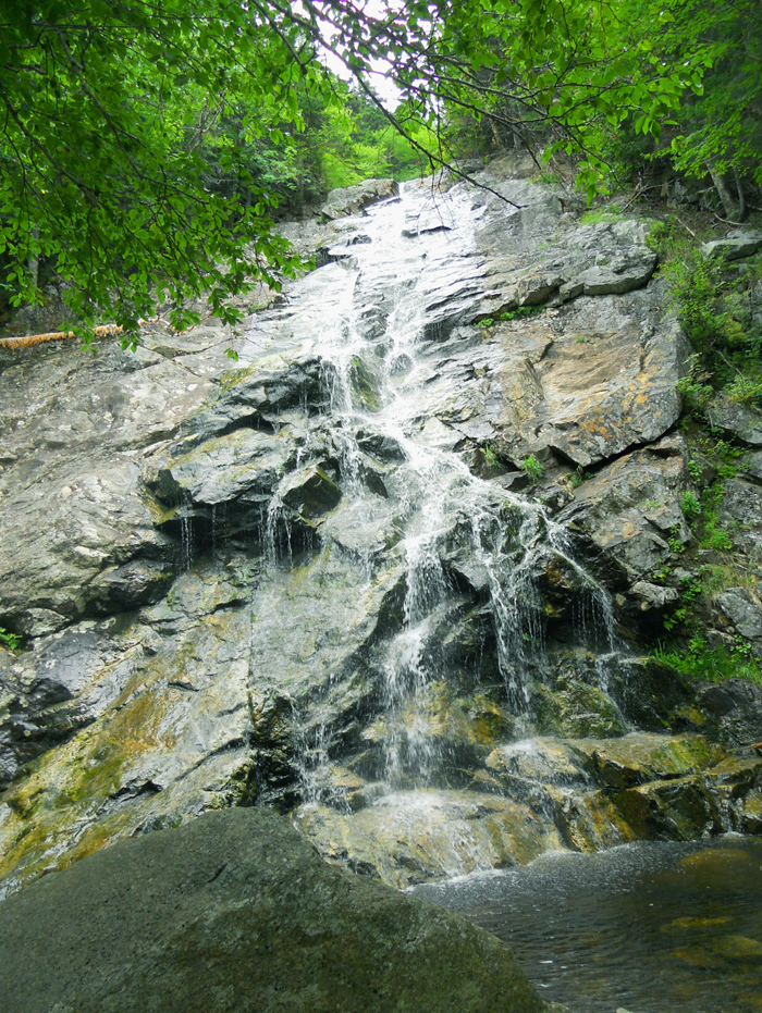
I love hiking. When I get the chance, I'll hike in the White Mountains of New Hampshire. Every year, when I hike, I find that there are some trails I enjoy hiking more than others. I have seen the views and look forward to seeing them again. I few trails in the White Mountains I have to visit all the time, each year, to get what I call "My fix". When I see the views, I almost go into a calming state and can just stare for hours without moving. Some of the views on these trails, make me feel like I am in some sort of Lord of the Rings Movie, I can see beautiful mountains that stretch on for miles. These three trails seem to always give me a feeling of leaving this world and being place in another. If you would like to trail on these trails, here they are:

1. The Air Line Trail: the journey up this trail is always exciting for me. It starts on Route 16, you can see a huge parking lot on one side that is normally full of cars. There are other trails that start at the same spot, but I always go up Air Line. I first hiked the trail back in 2004 and since then has visited it again over the years. I love when I get to the sign for the Alpine Zone. My heart starts beating faster because I know how amazing the views are up there. The trail rings around to the Mt. Madison Spring Hut and I seem to just take my time, I enjoy each step and stop to see all the views. this was the first time I felt like I was in Narnia or the Rings Movie. I was exploring a new world and meeting wonderful people along my way. Start of the Air Line trail to the Air Line Cutoff is 3.5 miles. It's worth the hike!
One of the first views you see when hiking up the trail

The mountain range


2. Another of my favorite trail to hike on is the Crawford Path. It doesn't seem to almost matter where on the Path I am, I just can't stop staring at the views. I really live the Path when I get close to Mt. Washington. You are so high up and you can see views from almost all sides. When I get closer to the top of Mt. Washington, I find myself turning around and taking pictures. My friends who hike with me say that it drives them crazy, for I am always stopping to see the views, but I can't help it! I am always in some sort of trance. So, as you are hiking from the Lake of the Clouds to the top of Mt. Washington, take a good look around, stop and breath in that wonderful mountain air, and enjoy the sights around you. I have to say, that is my most favorite part of the trail, which is 1.4 miles long.

On the Crawford path, looking back and seeing the lakes, mountains and hut.
3. I love hiking in Franconia Notch area. I have hiked just about all the mountains, but I got excited when my friend ask me last year to hike the Franconia Ridge. From Mt .Lafayette to Little Haystack we hiked the Franconia Ridge Trail which is 1.6 miles long. We had to make so many stops along the way for I needed pictures. My camera never seen so much use. Both sides the trail had great views but I loved the side that had no Parkway (highway 93). I loved the side where you could see the mountains stretch on for miles and miles.  If you ever have the chance to hike on this Ridge, it's worth all the views!
The view of the Parkway Valley

A view of the Ridge Trail and the mountains in the background
Now, I have many other wonderful trails that I love to hike and enjoy the views, these just happen to be my favorite so far. My adventures in the White Mountains are endless and every time I hike up, its a new experience. What are some of your favorite trails?

Happy Hiking!

Friday, October 12, 2012

A little Stop Along the way in Franconia

Not far from Franconia Notch is the town of Franconia. A nice, quiet town that holds some wonderful old treasures. I have enjoyed my stop there this summer where I got to see a stone Iron Furnace. One of the last that is still found up here in the North Country. Also, there was an old bridge, taht when you crossed it led to a small trail called Riverstone Beach Trail. It lead along the river bank where you can see different angles of the Stone Iron Furnace. If you enjoy seeing some history while hiking up here in the White Mountains, then this is a great place to stop. Along seeing the furnace, there is a small white building that holds some past treasures.
Here are a few pics:

The sign on the side of the road that lets you know you have arrived.

The sign to follow after the bridge to the trail.

The Stone Iron Furnace
Now, you can't go up to the furnace for it's on private property of the other side of the river. Hope you enjoy your time here in the White Mountains and Happy Hiking :)

Thursday, October 11, 2012

Calenders of the White Mountains designed and taken by Ariel Snow

I love hiking! I love the mountains! I love going on an adventure through the White Mountains. As I hike, I enjoy taking pictures at every great spot, view, and lookout in the mountains. In the past few weeks I have worked on a calender for my house and at the same time wanted to make it public for others to put up in their homes to enjoy. My first degree was graphic design and I enjoy taking breathtaking pictures. In this Calender you will see beautiful photos of Mt. Washington, Lonesome Lake, Franconia Notch, Crawford Notch, The Lakes of the Clouds and many more.

Come and check out this stunning calender and get one for your home to enjoy! 


Premium Calender $28.95
Standard Calender $17.95


These Calenders came be found on my Author's Spotlight called Adventure Shop:

 Click HERE

HAPPY HIKING! :)

Sunday, September 30, 2012

Great Autumn Loop in Franconia Notch

One Great Loop to hike in the White Mountains is the Franconia Ridge.  It is a great day hike that takes about nine hours or so to do. The start is at Lafayette Place Parking. Hike up .2 to a two way path, one being Falling Waters Trail and one being Old Bridle Path. Doesn't matter which way you decide to hike, there are so many wonderful great views. You will also then hike along the Franconia Ridge Trail and view landscapes from three different mountains. The loop is 8.8 miles and worth every step! 

What you will see along this great hike:
  • Stairs Falls
  • Swiftwater Falls
  • Cloudland Falls
  • Shining Rock
  • Little Haystack
  • Mt. Lincoln
  • Mt. Lafayette
  • Echo Lake
  • Greenleaf AMC Hut
  • Walker Cascades 
  • and many amazing views along Old Bridle Path
During Autumn the leaves are changing colors and the air is cool. You will see many views along the Ridge were the colors are beautiful. If you get a chance this fall to hike a wonderful loop, take this adventure in Franconia Notch! 

Hiking along the Franconia Ridge
Greenleaf AMC Hut
 Happy Hiking :)


Wednesday, September 5, 2012

Trail Report: Madison Hut and Mt. Madison

One of my favorite hikes is Mt. Madison. Back in 2005 I did this hike for the first time and then I have done it three more times since. It's a beautiful hike but is not easy. This is more of a moderate hike but the views will be worth the journey up the mountain. When you start this hike, its best to start at the parking on Route 2 near Randolph Hill. During the summer the parking fills up fast so get there early. Some people enjoy taking the Valley Way Trail up to Madison Spring Hut, but I prefer Airline Trail. It's easy at first but the trail gets steeper as you hike up. When you reach the sign that lets you know you have reached the Alpine Zone.
The Alpine Zone Sign

Hiking on the Airline Trail in the Alpine Zone

 Once you are hiking in the Apline Zone, you are above tree level. Here you will follow rock piles until you reach Madison Spring Hut. I love being above tree line for you get to see views all the way around you. Once you are over at Madison Spring Hut, you can go inside for restrooms and for resting. I enjoy a snack or even just have lunch inside at one of the benches. There is also a lake called Star lake down the trail for viewing.
Mt. Washington from Mt. Madison (sometimes you can see the cars driving up_

The marker on Mt. Madison

After a rest, hike up to the top of Mt. Madison, it is rocky, climbing over boulders at times but it will be well worth it! The views are amazing! I love seeing Berlin, Jefferson, Mt. Washington, top of Mt. Wildcat and more all around me. The hike will take about six to seven hours. After hiking back down Mt. Madison and back to the hut, I normally take Valley Way back down to the parking lot. It's not as rocky and hard on your legs. The hike it worth going up and if you want to see views...then this is the hike for you! Mt. Madison is 5366'
Madison Spring Hut

Inside Madison Spring Hut (have benches, bathroom and sleeping rooms)
Happy Hiking:)

Monday, September 3, 2012

Trip Report: Hiking up to Mt. Pierce and Mizpah Spring Hut

Mt. Pierce is located in the Presidential Range but you can hike it by parking near AMC Highland Center in Crawford Notch. There is parking across the street which will cost $3.00 per day. It's a moderate hike. Took us about five hours to hike the loop which was around 6.2 miles. It was a wonderful day hike.
Crawford Path is the oldest continuously used hiking trail in America

Gibbs Falls
We started on the Connection trail which is .5 miles over to the Crawford Path. We hiked up to Gibbs Falls which was beautiful. Great place to take a small break. Then after we continued up (1.7 miles) to the junction to Mizpah Cut-off. We wanted to see the Mizpah Spring Hut first so we hiked over which was .7 miles. When we got to the hut it was getting foggy. We could tell that rain was about to fall so we went into for a lunch break. Great hut, very clean and well thought out. I loved sitting by the windows while relaxing with a sandwich.
Mizpah Spring Hut

...entering Alpine Zone when approaching Mt. Pierce
 It was getting a little windy but didn't rain. They have a place where you can check for weather and it read 40% chance so we decided to hike up to Mt. Pierce. We started on the Webster Cliff Trail .9 miles up to the mountain. As soon as we were about .5 miles up it started to rain. The rain didn't last and we continued up until we reached Mt. Pierce. I am sure the view would have been amazing if it was a clear day, but it was very foggy when we reached the top. We did get to see a view mountains through the think clouds that rolled by.
View from top of Mt. Pierce on a cloudy day

View of the valley below where you can see Mt. Washington Hotel through the fog
 After we hiked down Crawford Notch path 3.1 miles back to the connection trail. Even though we didn't get much of a view, it was a great hike and I hope to hike it again next year.
Also Mt.Pierce is a 4000 footer, 4312' 

Monday, August 13, 2012

Trail Report: Avalon Tr, A-Z Tr, Mt. Tom, Crawford Notch

The starting point of the first trail is at the Crawford Deport in Crawford Notch. When we arrived at the parking it was full. During this time of year, this is a very popular place to hike so parking is limited. You can park on the edge of the road which we did. The great park though of coming later is the train that arrives at the station from North Conway bringing visitors.

I was on the trail side when taking this picture of the train when it stopped at the station. We headed up the trail which is called Avalon Trail. My stepson and I had hiked this trail to Mt. Avalon in the early spring. Great views from Avalon. As you travel up the path you will come across a sign that says Beecher and Pearl Cascades. You can take that trail around and it will lead you back to the main trail. There you will see two cascades.
After hiking up Avalon trial for 1.3 miles, we connected onto A-Z trail which brought us up to Mt. Tom Spur Trail. We had traveled 1.0 up on A-Z trail before connecting onto Mt. Tom Spur. At that point my stepson wanted a break, so we had a snack. That spot was a great resting stop, had a few logs to sit on and it was shady. Then we hiked up Mt. Tom Spur to see the view. There are two places to view the mountains around. Here are a few pictures I took:


There were some short trees to have to take pictures over, but I stood on the highest point. I have to say that it wasn't the best views but I still got some nice pictures. The hike all together was 5.6 miles. We hiked for about five hours, stopping a few times. Mt. Tom is 4051 feet, making it a 4000 footer!
Happy Hiking!

Monday, August 6, 2012

Trail Report: Nancy Pond Trail, Nancy Cascades and a wonderful surprise

This adventure takes us to Nancy Pond Trail, which leads to Nancy Cascades and Nancy Pond. Sadly we never ended up going all the way up to Nancy Pond for dark clouds rolled in when we were at Nancy Cascades.
I have always wanted to hike this trail ever since I heard the story about Nancy. The girl's name was Nancy and she went searching for her love. The man she was going to marry left to fight in a war and she went after him. She traveled through the woods in the middle of winter back in the 1800's. When word got out that she went after him, people went looking for her and they found her near Nancy Brook (which was named after her) and she was sitting on a rock, frozen to death. It is such a sad story. I wanted to hike the path where this girl is buried near by along side the river she was following.
The Trail starts on route 302, there is a small parking area, for its not a busy trail to hike. The trail is wide at the start and easy to follow. You cross two brooks, Halfway and Nancy on the way up to Nancy Cascades.
The sign at the start of the trail

The first brook we stopped for Stitch to drink at, he loved the water.

This sign was when we got to Nancy Brook Scenic Area. It is large and you can read it easy. The Red area is the Nancy Area where you will find the Cascades and Pond of Nancy. But we also got a fun surprise...we came upon a very old maple sugaring house. You could tell that it was old and hasn't been used in many many years.

 We weren't sure what this was but we knew it was old and must have been hanging in the trees. The nails in the front were hand made for the ends were squares. The other end had hooks so we knew it must have been used for collecting the sugar from the trees.

These two pictures is of the sugaring house. It has trees growing around and inside of the house but you can see some old rusted cans around the house which they used to keep the sugar syrup in. I love seeing old places like this one, it makes you think back to when they used it. The sugaring house is about two miles from the road...
 After seeing the sugaring house we soon crossed Nancy Brook and came upon Nancy Cascade. It was so beautiful and made lunch while sitting on the boulders. We headed back due to rain clouds which did decide to burst on us while we were still a mile from the car. Nothing like hiking in the rain:)
Nancy Cascades

Our hiking trip was 4.8 miles in all. Easy hike. Happy Hiking!

Monday, July 23, 2012

Trail Report: Tuckerman Ravine Trail Pinkham Notch

I haven't hiked over in Pinkham Notch in a few years so I was excited to get a chance to drive over to the Pinkham Notch Visitor Center on Route 16. The Pinkham Notch Center is  in between Wildcat and Glen Ellis Falls. At the Center there are many trails you can hike and if you want to stay for a night or longer HERE TO SEE ABOUT LODGING on Joe Dodge Lodge at Pinkham Notch Visitor Center. I enjoy visiting the gift shop and also great place to eat.
The trail we took was the Tuckerman Ravine Trail which starts at the Center and headed up to Hermit Lake Shelters. The trail is very rocky and opened. It is easy to hike up as a group and stay together for you can see long distance in most parts plus its wide. When you are .4 miles on the trail you will also come up to Crystal Cascade which is beautiful. There are a few bridges to cross but the hike is wonderful. Its 2.3 miles to the Center to Hermit Lake Shelters. 


The sign at the beginning to show the trails

The information board to check out before going on trail

Crystal Cascade

What you see when you reach Hermit Lake Shelters: Tunkerman Ravine
Now, from here we went another .7 miles to get closer to the base floor of the Ravine bowl. We had started hiking a little late in the day so we didn't have time to go up to Lion Head. Lion Head is located up on top of Tuckerman Ravine on the right side. My stepson enjoyed getting water from a Pump that was near the trail going to the base of the bowl. The water was cold which was wonderful.
getting fresh cold water from the pump

Close to the Base of the bowl

Can see Wildcat from the Base of Tuckerman
The hike was wonderful. It was a 6 miles hike round trip. Its a great hike for everyone to do and its a very well kept up trail. Happy Hiking!

Related Posts Plugin for WordPress, Blogger...